Weather warning from the Iceland Met Office for Sunday
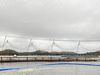
The weather is taking a sharp turn for the worse tomorrow, with snow and gale force winds. Many mountain roads are likely to become impassable. Iceland Monitor/ Árni Sæberg
The Icelandic Meterological Office has sent a weather warning for tomorrow, Sunday, for heavy snowfall and gale force winds.
The warning is as follows:
Heavy snowfall is expected in places in the northeast part of Iceland tomorrow afternoon. Strong gale force winds (mean wind more than 20 m/s) are forecast in the West Fjords over night and tomorrow morning, but tomorrow evening in the southeast and east parts. Windgusts of around or more than 40 m/s can be expected near Vatnajökull tomorrow evening with chances of dust storm.
Weather outlook in Iceland until midnight tomorrow:
Southwest 5-13 m/s and rain or drizzle in most parts of the country. Temperature 3 to 8 degrees C. Northeast strong gale wind with snow in the Westfjords over night. Increasing northerly wind elsewhere in Iceland tomorrow, 13-20 m/s in the afternoon, but 18-25 by evening in the southeast and east parts. Sleet and later snow in the northern half of the country, heavy precipitation in places between Tröllaskagi and the Eastfjords. Scattered showers of rain or snow in the south. Becoming cooler, temperature around zero tomorrow afternoon, but above zero in the south.
Remarks from the forecasters
Snow is forecast tomorrow and until Monday afternoon. Typical amount of snow
during the period could be 10-20 centimeters in the Westfjords and Northwest
Iceland, but 20-30 cm from Tröllaskagi and eastward towards the Eastfjords. These
numbers assume that the snow will spread evenly, which it will not, because snowdrift
is likely during the strong winds that are also forecast. It is likely that roads in the area
will become slippy or impassable, especially the mountain roads, where blizzard
conditions could prevail. The risk of avalanches is expected to increase in mountains.