Earthquake in North Iceland
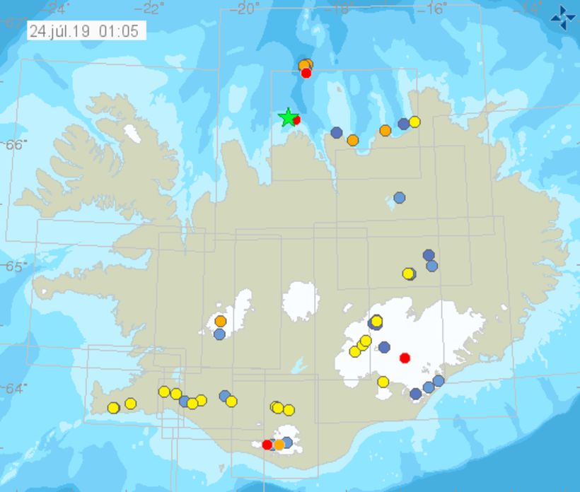
The source of the earthquake was about 20 km north-northwest of Siglufjörður. Map/Icelandic Met Office
An earthquake of magnitude 4.3 hit North Iceland just before 1 am today, the Icelandic Met Office reports. The source of the earthquake was about 20 km (12.4 mi) north-northwest of Siglufjörður. It was widely felt in North Iceland, all the way from Strandir, in the west, to Húsavík, in the east. Several aftershocks have been recorded, the largest one measuring 2.7. The source appears to be at a depth of 8-10 km.
The temblor occurred due to tectonic movement on the Tjörnes fracture zone.
In the fall of 2012, a series of earthquakes hit a nearby area, the largest one of magnitude 5.6. Last year, three temblors in excess of magnitude 3 hit the area, but today’s quake is the area’s first one in excess of magnitude 4 since 2012. There are no reports of damage.
RÚV quotes seismologist Einar Bessi Gestsson, who states that there is no indication at this point that today’s earthquake was an unusual event. He notes that more aftershocks are to be expected, probably of magnitude 3 or so.