Skógareldarnir séðir frá geimnum
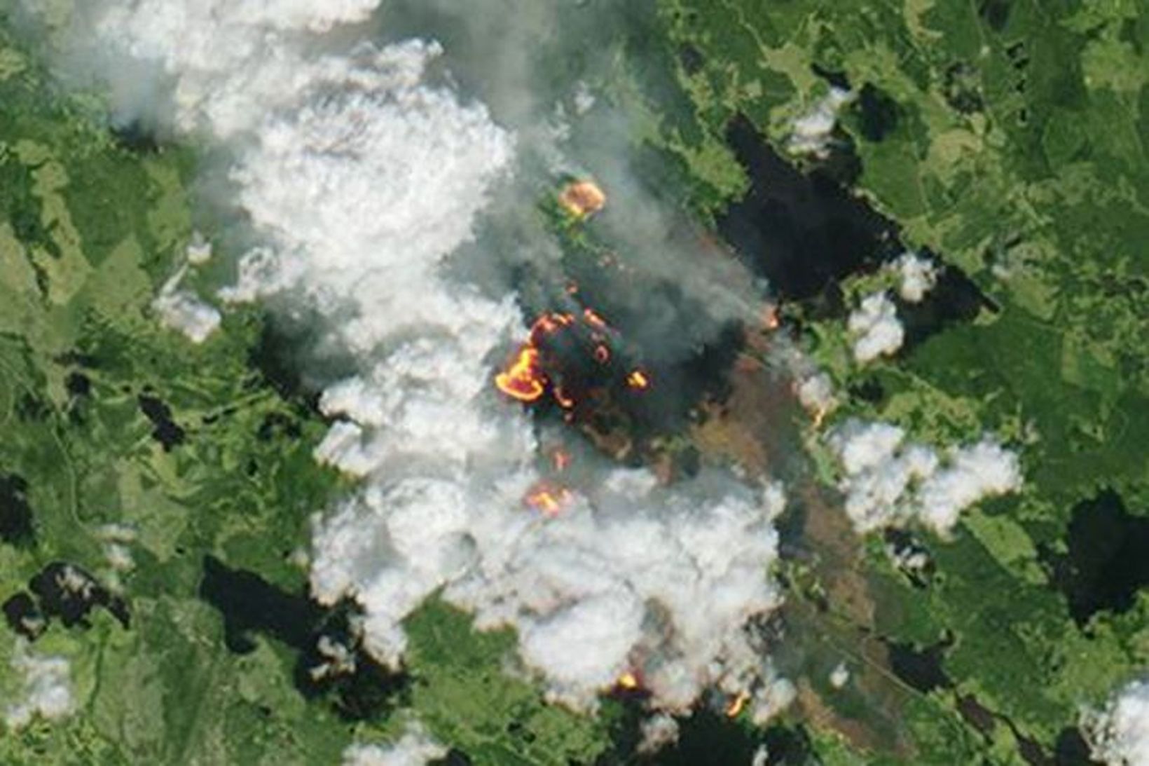
Fjórir stærstu eldarnir eru í Dölunum, Gävleborg og Jämtlandi. Hér má sjá einn þeirra á mynd sem tekin var utan úr geimnum.
Ljósmynd/ESA
Evrópska geimferðarstofnunin, ESA, hefur birt myndir af skógareldunum í Svíþjóð. Á þeim má sjá hversu útbreiddir þeir eru og hversu glatt logar í skógunum.
Verstir eru eldarnir í Dölunum, Gävleborg og Jämtlandi. Margir hafa þurft að yfirgefa heimili sín á þessum slóðum. Helst er óttast að fólk verði innlyksa þar sem eldar loga beggja vegna sumra vega frá bæjum á svæðinu.
Frétt sænska ríkisútvarpinu um málið.
The @CopernicusEU #Sentinel2 and #Sentinel3 missions give a unique view of the fires currently burning through the Arctic Circle, in Sweden: via @esa https://t.co/FIhdQwf6ZW pic.twitter.com/HXJX06f3TG
— EGU (@EuroGeosciences) July 22, 2018
Our @CopernicusEMS #RapidMappingTeam has a new activation, this time for wildfires in #Sweden
— Copernicus EU (@CopernicusEU) July 17, 2018
While we wait for up-to-date and usable satellite data, here are the fires in Enskogen (1 and 2) and Hammarstrand (3) as seen by #Sentinel2 🇪🇺🛰️
Stay tuned at https://t.co/5uZ4UYcZjW pic.twitter.com/hqxBRpQJFR
Fleira áhugavert
- Hleypt úr fangelsum til að berjast við eldana
- Óskar föður sínum dauða í fangelsi
- Flugritar hættu að virka mínútum fyrir slysið
- Bandaríkin bjóða 3,5 milljarða fyrir Maduro
- Kallar eftir rannsókn á vatnsleysi
- Myrti móðurina og krefst forræðis barnsins
- „Guði sé lof, það var þarna enn“
- 60 þúsund byggingar taldar í hættu
- Dæmd fyrir svívirðilegt brot
- Kom úr felum og var handtekin
- Kom úr felum og var handtekin
- „Guði sé lof, það var þarna enn“
- Myndir: Hamfarir í Los Angeles
- Borgarstjóri LA virti blaðamenn að vettugi
- Þremur milljónum skráninga lekið
- Skipuleggja fund: „Hann vill hittast“
- NATO sendir herskip á Eystrasalt
- Ríkisstjórn Trumps virðist ekki átta sig á málinu
- Trump sekur án refsingar
- Myrti móðurina og krefst forræðis barnsins
- Íslensk fjölskylda í LA: „Algjört neyðarástand“
- Þremur milljónum skráninga lekið
- Stórbruni í Ósló
- Kom úr felum og var handtekin
- 18 ára drengur fangelsaður í Dúbaí fyrir samræði
- Fimm skotnir til bana á bar
- Segir fyrr munu frjósa í helvíti
- Segir bróður sinn hafa nauðgað sér
- Neituðu að birta mynd af auðjöfrum krjúpa fyrir Trump
- Útilokar ekki að beita hernum til að ná Grænlandi


 Þyngra en tárum taki
 Enginn fundur á dagskrá og stefnir í verkföll
 60 þúsund byggingar taldar í hættu
 Þingmenn stjórnarflokkanna funda á Þingvöllum
 Hefði mjög gjarnan viljað hitta hann
 Varnarmál í norðri munu fá meira vægi
/frimg/1/35/4/1350480.jpg) Íslendingar ekki duglegir að fara í inflúensubólusetningar
Íslendingar ekki duglegir að fara í inflúensubólusetningar
 Stefnt að því að auka ekki útgjöld á árinu