Lava-field the size of Manhattan
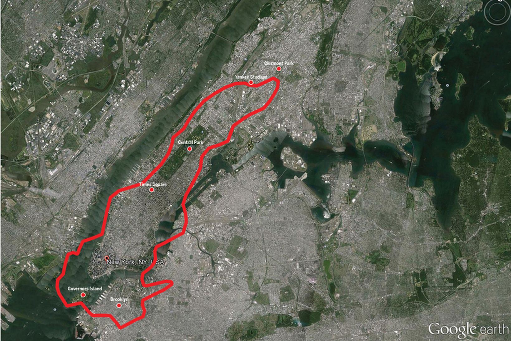
The lava-field stretches from Governors Island and Brooklyn, covering nearly all of Manhattan and extending all the way to West Bronx, coming to a halt just south of Claremont Park.
© mbl.is
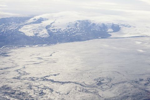
The lava-field in Holuhraun is big. Very big, even. Longer than a bunch of football fields put together and bigger in volume than a whole lot of Empire State buildings full of lava. From point-to-point, it measures around 19 kilometers, nearly 12 miles.
The problem is that when you have something bigger than, say, ten football fields put together, you kind of lose track of just how big that something is. How many football fields, end to end, would it take to cover the distance from Vienna and Munich? Probably quite a few, more than you can easily imagine, and too many for it to give a clear picture of the distance.
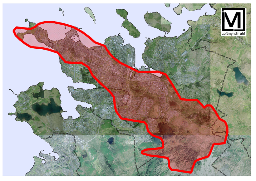
That's why we asked our friends at Loftmyndir ehf., an Icelandic cartography firm, to help us put things into proportion. The maps are, of course, property of mbl.is and Loftmyndir. The outlines used in the maps are of the field as it was on September 16th.
The first map shows the lava-field stretching from Governors Island and Brooklyn, covering nearly all of Manhattan and extending all the way West Bronx, coming to a halt just south of Claremont Park.
From Brooklyn to Bronx
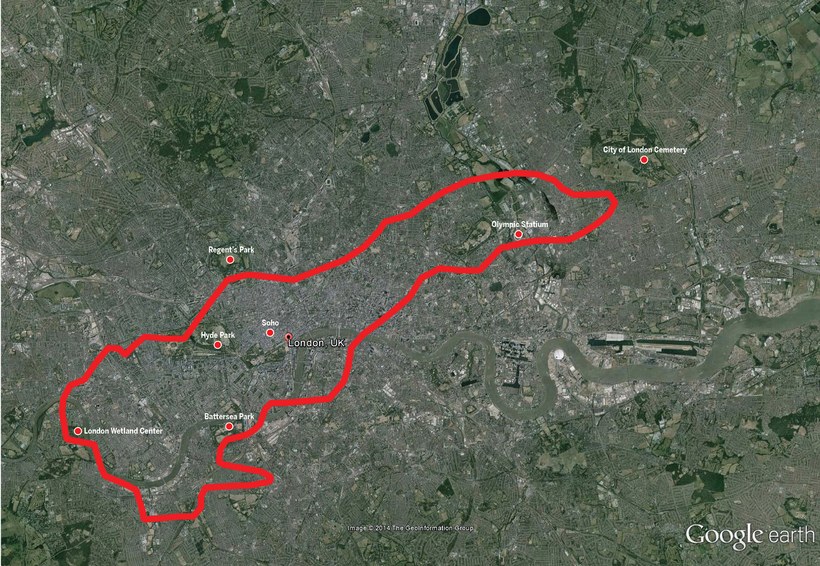
If Manhattan is not you thing, you can also see the lava-field on map two over London. The field would cover an area from the London Wetland Centre in the west, engulfing Hyde Park, Green Park and Battersea Park, touch the southern tip of Green Park before coming to a halt just short of the London Cemetery.
That's quite a bit of lava. Big Ben, the Palace of Westminister, Downing Street, Soho, Covent Garden and the British Museum would all be under the lava-field, which of course is not many stories tall, so the buildings would of course not be under lava. This is just to show the sheer size of the lava-field.
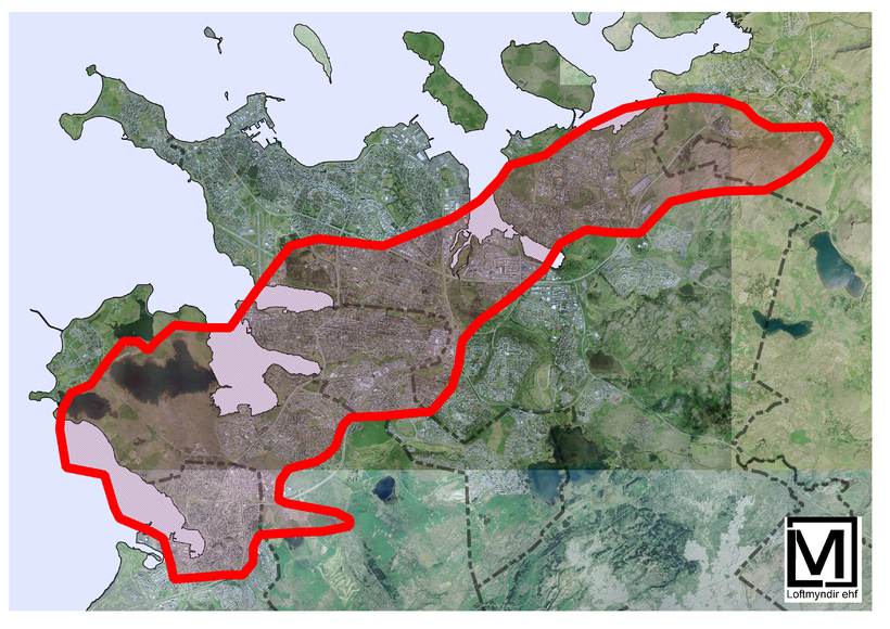
Lastly, the lava-field has been put in proportion with the greater Reykjavík area. On the third map, the southern tip of the field is in Hafnarfjörður, with the other end in the town of Mosfellsbær. This map is the only one that shows the lava-field in the exact same way as it is in Holuhraun, in terms of it not having been turned as is the case with maps 1, 2 and 4.
On map four the field has been turned to cover the area in a different way. Now it stretches from the area just east of Reykjavík, all the way past the tip of the Seltjarnarnes peninsula.
Next time you visit Reykjavík, try taking a short hike to see just how long it would take you to cover the distance of one fresh Holuhraun.
The field would cover an area from the London Wetland Centre in the west, engulfing Hyde Park, Green Park and Battersea Park, touch the southern tip of Green Park before coming to a halt just short of the London Cemetery.
© mbl.is
The southern end of the field is in Hafnarfjörður, with the other end in the town of Mosfellsbær. This map is the only one that shows the lava-field in the exact same way as it is in Holuhraun, in terms of it not having been turned as is the case with maps 1, 2 and 4.
© Loftmyndir ehf.
